
The content is stated in the Resolution on urban planning management according to the Transit-Oriented Development (TOD) model, passed by the Ho Chi Minh City People’s Council at its 3rd session on the afternoon of June 19.
Accordingly, the ratio of low-rise housing is considered an important criterion to promote the compact city model around metro stations, optimizing land use efficiency and generating financial resources for the urban railway system.
TOD (Transit-Oriented Development) is an urban development model centered on public transportation. Although implementation methods may vary by locality, the common feature of this model is high-density, multi-functional development, including high-rise housing, commercial centers, and offices, along with educational, medical, and sports facilities. All are integrated within walking distance around public transport hubs such as metro stations to ensure the most convenient connectivity. This model aims to enhance the efficiency of land and public facility usage, and limit pollution by reducing personal cars and motorbikes.

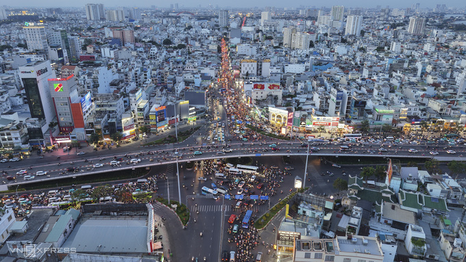
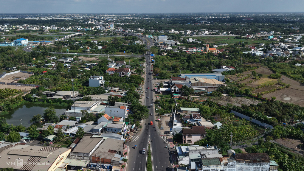
Hang Xanh Intersection, an area proposed for TOD development. Photo: Thanh Tung
Hang Xanh Intersection, an area proposed for TOD development. Photo: Thanh Tung
According to the Resolution of the Ho Chi Minh City People’s Council, TOD areas are defined within a radius of about 1 km from the center of a station or depot. The city can also expand beyond this scope if necessary to ensure synchronized connectivity in technical infrastructure, architectural space, and urban landscape.
Explaining the limit of low-rise housing to under 20%, the city government stated that the area around the stations is high-value land that requires prioritizing high-rise, multi-functional buildings to increase the land use coefficient, concentrating population and commercial and service activities near public transport. This helps increase the number of passengers using the metro, effectively exploits the added value from land, and creates reinvestment revenue for the urban railway network.
The core goal of TOD is not only to plan the urban space around the stations but also to create mechanisms to exploit the value of land, underground space, and overhead space to form sustainable financial resources for public transportation. Limiting low-rise housing also helps avoid urban sprawl, which reduces the efficiency of infrastructure investment.
However, the city still maintains a certain ratio for low-rise housing to create flexibility in urban embellishment, social housing development, or areas not yet suitable for immediate high-rise construction. The 20% level is referenced from the regulations on reserving land funds for social housing development in residential projects.
Besides the regulations on housing, the Resolution also introduces many specific planning mechanisms for TOD areas.
Specifically, the gross land use coefficient for mixed-use, commercial-service, and residential areas is allowed to increase up to 1.5 times compared to current standards. Instead of strictly applying this to each land plot, this coefficient is calculated as an average for the entire TOD area, allowing for a high construction density concentrated around the stations and gradually decreasing in areas further away. This approach helps form high-density development poles linked to public transport while increasing investment attractiveness.
Social infrastructure indicators such as schools, medical facilities, and public works are allowed to decrease by up to 50% compared to standards and are balanced across the entire metro line instead of individual stations. According to the city, with the fast connectivity of the urban railway system, residents can access amenities at nearby stations in a short time. Concentrating large-scale school and hospital complexes at certain specialized stations will improve investment efficiency and the quality of public services.
Similarly, the parking area is allowed to decrease by up to 50% to encourage residents to switch from personal vehicles to walking, cycling, and public transport. The saved area can be dedicated to public spaces, commercial services, or other urban functions with higher economic value.
The Resolution also allows flexibility regarding building setbacks, converting a portion of green space on roofs and upper floors into public green space indicators, and arranging mixed-use buildings right at stations and depots to efficiently exploit the space.
According to the city government, all the above adjustments aim to build a compact city model around public transport hubs, generate additional revenue from land, attract investment, increase passenger volume for the metro, and contribute to completing the urban railway network according to the city’s development roadmap.


Leave a Reply